Salvaging history and mapping Zane’s Trace
By Mike Ryan, OCJ Field Reporter
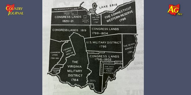
The Zane’s Trace was the first official road blazed into the Ohio country after the Revolutionary War in what was then the Northwest Territory. This original wilderness path was cut through 230 miles of deep, yawning primeval forest; it started at Wheeling (in what is now West Virginia) and passed through 11 present-day Ohio counties — Belmont, Guernsey, Muskingum, Perry, Fairfield, Pickaway, Ross, Pike, Highland, Adams, and Brown — before reaching its terminus at the town of Aberdeen that lies across the Ohio River from Limestone (present day Maysville), Kentucky.
The road was built in 1796-1797 under the direction and leadership of Revolutionary War Colonel Ebenezer Zane. For payment for road construction, the federal government gave Zane tracts of land at three river crossings along the route–the Muskingum, the Hocking, and the Scioto — with the stipulation that Zane create fords or ferries at these locations to aid in future travel.… Continue reading