State Unveils Color-Coded County-By-County COVID Map
Governor DeWine unveiled the Ohio Public Health Advisory Alert System to help make clear the dangers happening in Ohio counties due to the coronavirus.
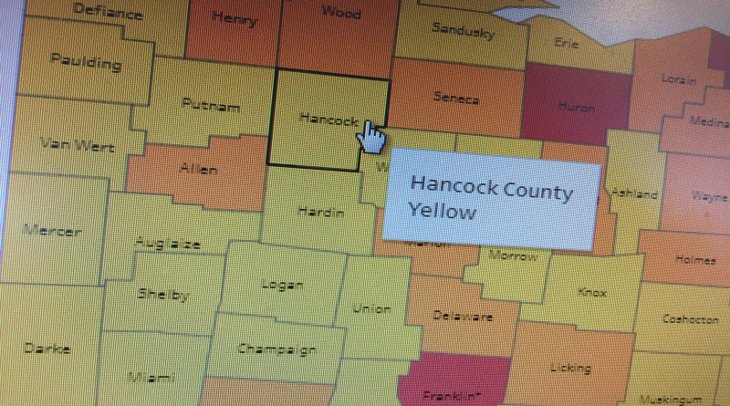
The four-level color-coded system is built on data to assess COVID-19 spread and inform and empower individuals, businesses, & local governments in their response.
Level 1 counties are in yellow, which signifies active exposure and spread.
Level 2 counties are in orange, which signifies increased exposure and spread.
Level 3 counties are in red, which signifies very high exposure and spread.
Level 4 counties are in purple, which signifies severe exposure and spread.
Hancock County was on the yellow level as of Monday.
Franklin County was red, and approaching purple.